•  Help Center
    •  License Agreement
    •  Contact
  • Workspace
  • Exports
Status Saved? Publisher Service Title Keyword Site Name Variable Name QCLID QC Level MethodId Method Method Link SourceId Collector Variable Units Data Type Value Type Sample Medium General Category Start Date End Date Value Count (est.) Time Support Time Unit Series Id WaterOneFlow URI Created TimeSeriesRequestId
Request ID
  • SEARCH

Select Dates


  1. All
  1. All
  1. All


Time Series Found

Filters... Filters go here!!!

Contact

Consortium of Universities for the Advancement of Hydrologic Science, Inc. (CUAHSI)


150 Cambridepark Dr, Suite 203
Cambridge, MA 02140
Phone: (339) 221-5400
Fax: (781) 219-4029
Support: help@cuahsi.org

Need additional help

License Information (Version 1.4.7)

Distribution

HydroClient and all associated source code and documentation are available at the following URL: http://www.github.com/cuahsi. HydroClient source code and documentation are provided free of charge under the Berkeley Software Distribution (BSD) license. Please see the following license information: Copyright (c) 2015, CUAHSI, All rights reserved.

Redistribution and use in source and binary forms, with or without modification, are permitted provided that the following conditions are met:

  1. Redistributions of source code must retain the above copyright notice, this list of conditions and the following disclaimer.
  2. Redistributions in binary form must reproduce the above copyright notice, this list of conditions and the following disclaimer in the documentation and/or other materials provided with the distribution.
  3. Neither the name of CUAHSI nor the names of its contributors may be used to endorse or promote products derived from this software without specific prior written permission.

This software is provided by the copyright holders and contributors "as is" and any express or implied warranties, including, but not limited to, the implied warranties of merchantability and fitness for a particular purpose are disclaimed. In no event shall the copyright owner or contributors be liable for any direct, indirect, incidental, special, exemplary, or consequential damages (including, but not limited to, procurement of substitute goods or services; loss of use, data, or profits; or business interruption) however caused and on any theory of liability, whether in contract, strict liability, or tort (including negligence or otherwise) arising in any way out of the use of this software, even if advised of the possibility of such damage.

Appliation code integrated into this application was originally developed for HydroDesktop. For more information about this open source GIS software visit www.hydrodesktop.org and see: Ames, D.P., Horsburgh, J.S., Cao, Y., Kadlec, J., Whiteaker, T., and Valentine, D., 2012. HydroDesktop: Web Services-Based Software for Hydrologic Data Discovery, Download, Visualization, and Analysis. Environmental Modelling & Software. Vol 37, pp 146-156. http://dx.doi.org/10.1016/j.envsoft.2012.03.013.

It also relies on DotSpatial developed by Dan Ames (https://dotspatial.codeplex.com)

Disclaimer

Although much effort has been expended in the development and testing of the HydroClient, errors and inadequacies may still occur. Users must make the final evaluation as to the usefulness of HydroClient for his or her application. HydroClient, CUAHSI HIS, and documentation are supported by National Science Foundation Grant Number EAR-1248152. Any opinions, findings, and conclusions or recommendations expressed in this material are those of the authors and do not necessarily reflect the views of the National Science Foundation.

Quick Start

Data Types Available

Meteorology

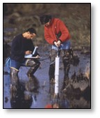
Ground Water

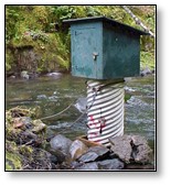
Surface Water

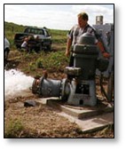
Water Quality

a HydroClient helps you discover, download, and analyze environmental data from many different sources including U.S. Federal Agencies, International governments, non-profit organizations and academic projects.

For more info please check our User Guide

Tutorials:

  • Tutorial-Examining-Discharge-and-Precipitation-Data-near-Lake-Tahoe-California
  • Tutorial-Investigating-Air-Temperature-with-HydroClient-and-RStudio

Searching for Data

Discover data by specifying the :

  • Define the search parameters on the right-side panel by Date Range, Keywords, Data Services, or Advanced Search options
  • Filter your search results on the right-side panel where it says “Filter Results”
  • Narrow your Geographic extent and clicking “Search Now” on the right-side panel
  • Monitor the number of time series found by looking at the right-side panel where it says “Time Series Found”
  • Search results will only appear plotted on the map and in the table of Search Results once there are less than 25,000 time series found.
  • Date range you are interested in by selecting start and end dates


For additional questions or feedback email support

Filter Results

  • Click on the blue data markers that appear on the map. Blue data markers will only appear once there are less than 25,000 time series found.
  • Click on Filter Results to view a list of all current results and to download or preview plots of data series

View a List of Results

  • Click on Filter Results, filtering options can further narrow the search results
  • Click to select Keywords, Data Properties, and Data Services
  • Once a selection is made, the filtering options will narrow to represent only the current results.

Using the Layer Control

Click on the Layer Control to open up a list of three layer choices:

  1. USGS Stream Gages
  2. Nationalmap Hydrology
  3. EPA Watersheds

All three layers can be turned on at once.

Click for more information on the Layer Control

Using the Workspace

Once you have discovered data, export it to your computer or save it to your HydroClient Workspace. The HydroClient Workspace contains tools like the Data Viewer that you can use to analyze the data. Sign into HydroClient with a Google account to save the contents of your Workspace beyond a single browsing session and access additional exporting capabilities.

Click for more information on the workspace

Exporting Data

Once you have discovered data, you can export it to your local computer as a .csv. If you are signed in with your Google Account, you'll see two options for exporting data series:

  1. Export selection(s) in a combined file
  2. Export each selection in a separate file.

Option (1), Export selection(s) in a combined file, is only visible to signed in users. Combined file formats display the data series stacked on top of one another so that several series can be viewed at once.

Click for more information about exported file formats

Plot Data

In the Search Results table:

  • Click to highlight the data series of interest
  • Click Select Action and select to Save Selection to Workspace

In the Workspace:

  • Click to highlight up to five data series at a time
  • Click Select Action and choose Data Series Viewe
  • Click Launch tool
  • The Data Series Viewer will pop up in a new window

Load your own Geospatial Layers

You can upload your own layers as Geojson file types:

  • Click on the Layer Control and select to Add Geojson
  • Browse and select the Geojson file on your computer

Check out the Help Center

Check out the Help Center or email support for additional questions and feedback

Server Error

An error has occurred on the server - please re-submit your search criteria...

Server Message:

Loading Keywords...

Physical

Chemical

Biological

Searching...

In Progress

Please select your date range:

Please select your Keyword(s)

(No selection searches all)
  •  Common 
  •  Full List 

Click to select Data Services

(No selection searches all)
Organization ServiceCode Title DescriptionUrl ServiceUrl Checked Sites Variables Values ServiceBoundingBox ID
Note: Many data services listed here are maintained by the data publishers. CUAHSI cannot be held responsible for the status of these servers. All data publishers are responsible for the accuracy of their data.
 

Search Results in area

Publisher Service Title Keyword Site Name Data Type Value Type Sample Medium General Category QCLID QC Level MethodId Method SourceId Collector Start Date End Date Value Count (est.) Variable Name Time Support Time Unit Service URL Site Code Variable Code Series Id ServURL ServiceCode VariableUnits

Download

Advanced Search

Data Properties

  • Data Type
  • General Category
  • Sample Medium
  • Value Type

Loading Data Types...
Term Occurrences Definition

Loading General Categories...
Term Occurrences Definition

Loading Sample Media...
Term Occurrences Definition

Loading Value Types...
Term Occurrences Definition
 

Filter Results

Keywords

Data Properties

Data Services

Found:  Filtered Results:
Publisher Service Title Keyword Site Name Data Type Value Type Sample Medium General Category QCLID QC Level MethodId Method SourceId Collector Start Date End Date Value Count (est.) Variable Name Time Support Time Unit Service URL Site Code Variable Code Series Id ServURL ServiceCode VariableUnits

GeoJson Upload

Please select your geojson file or Drag and Drop it onto the map

Warning! File not correct. Please validate input!

Selection Help

  • Select a single table row (and remove all previous selections)

    • Position mouse pointer anywhere over any unselected row
    • Left-click on mouse
  • Select multiple single table rows

    • Select single row as above
    • Position mouse pointer anywhere over any unselected row
    • Hold down CTRL key (Windows) or Command key (Mac)
    • Left-click on mouse
  • Deselect a single table row

    • When one row selected
      • Position mouse pointer anywhere over selected row
      • Left-click on mouse
    • When multiple rows selected
      • Position mouse pointer anywhere over one selected row
      • Hold down CTRL key (Windows) or Command key (Mac)
      • Left-click on mouse
  • Select a range of table rows

    • Given a selected row (start of range)
    • Position mouse pointer over an unselected row (end of range)
      • Note: The ‘end of range’ row can appear before or after the ‘start of range’ row, on the same table ‘page’ or a different ‘page’
    • Hold down SHIFT key (Windows and Mac)
    • Left-click on mouse